How it started
I first heard of the Trans Pyrenees Race (TPR) back in 2019. It was the first year that the race had taken place. Part of the idea of the race that was launched by Lost Dot, which is the team behind the Trans Continental Race, was to create a race that could be completed in a week rather than the two weeks most riders need to complete its bigger brother.
In 2019, I dot watched and followed all the social media coming out of the TPR and I was in awe of the 107 riders that took to the start line and rode their way across the Pyrenees, not just once but twice, covering 1500 km in a week with an insane amount of climbing. It seemed unbelievable but I was hooked. When the registration window opened up for the 2020 edition of the race I naively applied. At the time I think my longest ride had only been probably 120 miles and I had certainly not done back to back days riding unsupported. It was a whole new world to me and one which would require a big step up in training. At the time, I had one year to get in shape.
Everything changed in 2020. I had secured a place in the race but the pandemic had taken hold so it was postponed. Roll forward another year and in 2021 the race was again postponed. The postponements were both a blessing and a bind. It certainly gave me more time to gain some experience in multi-day ultra distance cycling, but for two years the TPR loomed on the horizon forever in my thoughts. That itself was exhausting at times, let alone the increased load in training.
I used the extra time wisely by taking on a raft of new rides both off-road, on road, mixed terrain and then finally London Edinburgh London in August of 2022. All of these were building up to the big one — TPR № 2 2022.
The race
The format of the TPR involves passing through a series of official checkpoints (CP) as well as completing some set parcours (mandatory sections). This means that between the checkpoints and parcours, riders can choose their own route. Hours were spent pouring over available route options, comparing distance and elevation profiles of different routes to try and iron out as many of the climbs as possible. The route I settled on ended up at 970 miles (1560 km) with 32000 m (104000 ft) of climbing. To complete that within the official cut-off time of seven days would involve riding at least 140 miles, with 4500 meters of climbing, daily. I was hoping for a 5 or 6 day finish time.

Preparations for the race had gone well. With expert coaching from Tim Ramsden of Black Cat Cycle Coaching, I was in the best shape of my life. I had used London Edinburgh London, just six weeks before the start of the race, as a training ride to test out kit and fitness. I was as ready as I would ever be.
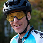
September 30, 2022 had arrived — finally after two years of thinking and training for the race I was on the start line of the TPR in Saint-Jean-de-Luz, a small fishing town on the Atlantic coast that has the Pyrenees to the east. One hundred and fifty riders had come together for the start at 06:00 on what was a dark and blustery morning. With the race taking place in September, sunrise was not until around 07:30 and sunset was at around 19:30; there was going to be plenty of riding in the dark. Rain was in the forecast for day 1 and after then it looked pretty favourable.
Milling about waiting for my start wave at 06:25, I was having last minute doubts. Had I done enough training, did I have the right kit, would my lights and bike computer work? I was fiddling with kit, changing clothes and looking at all the other riders, wondering if I could do the race justice. I reminded myself that all I was doing was going for a bike ride. Simple really.
Time to ride. My was cap number 100 and at 06:25 I set off into the darkness through the town and heading for the mountains. All the pre-start doubts ebbed away. It was time to focus on getting day 1 done.


Day 1—settling in

Having started in wave 6, there were plenty of riders already up the road. Their red rear lights on the horizon meant at least I was heading the right way. An hour or two of riding in the dark soon made way to daylight and by now all riders were closing in on CP1, only 40 miles from the start. The rain had held off so far and we were into the foothills of the Pyrenees. Approaching CP1 would involve the first real climb up to 660 meters elevation. Coming from Kent, where the highest point is only at 200 meters, this already involved a longer climb than I was used to. It was stunning and I had only gone 40 miles!


I arrived at CP1 atop the Col d’Ispeguy at 10:00 and had my brevet card stamped by one of the race volunteers. Phase 1 was done. All good so far. The rain had held off but just as I left the checkpoint to start my descent the heavens opened. Brakes on, then a rummage around to get the rain jacket on and then continue to enjoy the first of many long descents in the mountains.
My next target was the start of parcours 2. Based on the route I had planned that was 139 miles away. It’s here after CP1 that different route options would start to play out. Half the field went south, like me, into Spain for a long drag to Jaca and half kept north of the Pyrenees to then have to cross its spine to get to the start of parcours 2.
By now on day 1, the field had stretched out and I was riding on roads empty of cars and other riders. Occasionally, I’d see other riders as we all took a moment to resupply or get a moments rest. Already, I had crossed the French/Spanish border three times but from here I was to stay in Spain for the next day or two. The route I planned to parcours 2 followed the edge of the Yesa Reservoir which was not that full. In places you could see the remnants of the old villages that must have been in the valley before the dam flooded the area. With water levels so low, some visitors had taken the opportunity of getting their campervans onto the reservoir bed and were enjoying a dip in what looked like a cool stream. I was just turning the pedals enjoying the landscape.


What I’ve learnt from my limited experience in ultra distance cycling is that there is always some admin to do. It’s easy to forget the basics. Eating and drinking is a constant and I have found that regular alerts on my Wahoo bike computer work well to remind me every 20 or 30 minutes. The downside to constantly eating and drinking is the need to resupply when you can. I was in need of more water after six hours of cycling, but the route had little by way of shops along it. Instead, I took to seeking out water fountains that some villages had free to use. This in itself was an adventure. I discovered that not all water fountains are equal. Some were tucked away on a back street in a village and were ornamental gargoyles while others were very simple utilitarian taps. In either case, cold water was perfect on what was a hot day.
My objective for day 1 was to get close to, if not beyond, parcours 2. That would involve covering at least 180 miles. As it turns out, I only managed to cover 164 miles. As the sun was setting the temperature was dropping fast. It was at this time that the first signs of nausea were kicking in. I had been eating and drinking throughout the day, but the telltale signs were there. I stopped for a short break at a service station but could not get much food down.

Knowing that after the next town of Biescas there were not many other towns with accommodation, I took the chance to book into a hotel at around 20:00. It was an earlier finish to the day than I had planned, but given how I was feeling, it was a good call. It was fortunate for me that the hotel had a room available. The owner was intrigued and was wondering why he had bookings from several other cyclists for the night. I explained what we were doing and he thought we were all crazy. Coincidentally, he had heard of London Edinburg London and was wondering if it compared to that. Similar in distance but very different in terrain.
Biescas was also the intersection point for the riders that had stayed north after CP1, so there were a few of us around town getting dinner. I was joined by fellow rider Hector Kidds for dinner at a local restaurant. That was the first and last time I would see Hector. His pace was faster than mine. Having had dinner, I headed back to the hotel and went to sleep as soon as I could, ready for a 04:00 start in the morning.
Daily stats
Start: 06:25 Saint-Jean-de-Luz, FR
End: 19:56 Biescas, ES
Distance: 164 mi / 263 km
Elevation: 13589 ft / 4141 m
Elapsed time: 13 hr 34 m
Ride time: 12 hr 02 m
View on Map My Tracks
Day 2 — work to do

The alarm went off at 04:00 for the start of day 2. I had managed to get around 5–6 hours of broken sleep. I had terrible night sweats, so much so, that after a couple of hours I had to swap over to the other bed in the hotel room as the first was saturated with sweat. At the time, I didn’t think much about it as I had experienced some night sweats after previous long distance bike rides. I put it down to a supercharged metabolism activated by the previous day’s ride. A side effect of the night sweats was waking up dehydrated. I tried to get as much water inside me as possible before leaving the hotel to make up for what was lost over night.
When leaving the hotel at 04:40, I was soon joined by a steady stream of other riders also starting out for day 2. Immediately on the agenda was a seven mile climb gaining 600 meters and topping out at 1500 meters. With sunset still hours away, the climb was in the dark, so there was no chance to enjoy the scenery. Instead, I occasionally stopped, turned off all my lights and gazed up to look at the stars. With no light pollution to speak of, it was stunning. An hour after starting out, I reached the top of day 2’s first climb. From here it was descent down to Broto where parcours 2 would start.

Arriving at Broto, I stopped to change the route on my bike computer over to the next one. This simple act always feels like you’re making progress. A bit like family road trips of old when you could turn to the next page of the map. Parcours 2 was a 42 mile obligatory section of the race — everyone had to complete this. Each checkpoint and parcours had official cut-off times before which we needed to pass in order to stay officially within the general classification (GC). For parcours 2, riders would need to clear it by 19:00. I was well ahead of the cut-off times at this point in the race, so no pressure.
Parcours 2 was stunning! My thanks go to the race organisers for making this stretch mandatory, as once the sun was up, the mountains around revealed themselves in all their glory.


After several hours of riding, it was time to hunt down some breakfast. Escalona was fast approaching, and my mind was focused on a coffee and something other than left over pizza to eat. A short detour off the parcours into the town center soon presented the perfect pit stop — made better by the tell-tale signs of bikes ladened with bags parked outside. After a short exchange with me speaking English and the kind lady serving me speaking Spanish, I managed to get two coffees, toast and marmalade. Perfect. I think they too were wondering why all of sudden they had lots of cyclists passing through asking for loads of coffee.
I left the comfort of the restaurant at 10:00 with still 18 miles of parcours 2 to complete. It was steady 3–4% drag up from Escalona to Plan, the end of parcours 2. This stretch was amazing and it ticked off one of my main objectives of the race, which was to ride in remote, beautiful regions of the Pyrenees. Everything was great.


Parcours 2 was cleared by midday on day 2. I was still ahead of the GC cut-off times. From Plan, it was a free route to CP3, but the race organisers knew exactly what they were doing as there were very few options from here to get to CP3 without going up and over a gravel track. It was something all riders were prepared for. I was riding my Cotic Escapade gravel bike with 28c tyres, so all being well, it should cope nicely. Again, I thank the race organisers for forcing our hands to take this route. I got to ride my bike up to 2000 meters in the wilderness on a gravel track. It’s something I will never forget.


I cleared the gravel section at around 13:30 having covered just 76 miles since starting out at 04:40. It had taken nine hours to cover 75 miles with only 1000 meters of elevation. I would occasionally check out the live tracking page and could see that I was slipping behind my day 1 pace but was making steady progress. Now back on roads, it was time to try and make up lost ground.
CP3 was still 110 miles away. Its cut-off time was tomorrow, Sunday at 14:00, so I had around 24 hours to make it. There was no chance of me getting there on day 2, so my plan was to ride as long into the night as I could in order to get as close to it as possible. I set out to cover as many miles as I could.

Much like the night before, I had not booked any accommodation ahead. I was carrying a sleeping bag and bivvy just in case I needed it, but the plan was always to try and get a hotel for the night if possible. With sunset passing, I found myself struggling and knew that there were few towns down the road over the next few hours, so when I rode through Senterada at 19:30 I jumped at the chance to get a hotel room. This time I hit the jackpot. The lady at the hotel could not be more accommodating. Not only did I get the last room, I was just in time to get dinner as well. I later found out that just after I secured the room, she had a flurry of phone calls from other riders looking for a room for the night.
I got the usual set of daily chores done first. Wash and dry the kit as best as you can, have a shower, and get all the electronics on charge. Then it was dinner time for the best four course meal I’ve had for ages — all for €20.
Again, I had stopped a lot earlier than I had planned but my body was in charge and it was feeling the effects of the past two days. Knowing that I was starting to bump up against the cut-off times, I set the alarm for 03:00, giving me around five hours of sleep.
Daily stats
Start: 04:42 Biescas, ES
End: 19:32 Senterada, ES
Distance: 119 mi / 189 km
Elevation: 14498 ft / 4418 m
Elapsed time: 14 hr 50 m
Ride time: 11 hr 53 m
View on Map My Tracks
Day 3 — tough day

The alarm chimed at 03:00. Day 3 of the TPR had started. Again, the night’s sleep was broken up with more night sweats that required me to swap beds after a couple of hours. By now, three days in, the morning routine was familiar: forcing some food down, drinking as much water as possible, packing everything onto the bike, and heading off in the dark. At 03:00, the body doesn’t always want to co-operate, so eating little and often was the only way to get as many calories in as possible.
From Senterada, CP3, at Os de Civis, was 55 miles away deep in the Pyrenees just west of Andorra. The GC cut-off time was 14:00 in the afternoon. On paper I had plenty of time to get there before the cut-off time but the approach to this checkpoint had two options. A longer road route from Sort, climbing through Andorra, or the shorter Ruta del Contrabandistes gravel track from Tirvia to Os de Civis. I opted for the smugglers’ route up over the mountain.
Getting up and over the Ruta del Contrabandistes involved a 1000 meter climb, topping out at 2100 meters, deep in the heart of the Pyrenees. I was pleasantly surprised to find that the lower end of the climb was a smooth bitumen surface, but that soon gave way to a gravel track. As I was not feeling too strong at this point, I had to break up the climb into manageable chunks. I seem to do this a lot on ultra-distance rides. I’m sure other riders do the same as it helps to make the challenge ahead more manageable. For this climb, I settled on chunking it up into blocks of 100 meter elevation gain. For every 100 meters up, I would stop for 20–30 seconds to ‘enjoy the view’. Sometimes the 100 meters would happen quickly but at other times, due to the nature of switchbacks, there was quite some distance to cover to complete it.
Having gained all that elevation, it was time to descend 700 meters to the checkpoint below. The descent would have been magical on a mountain bike with suspension and nice wide tyres, but on a road bike with 28c tyres, it was a challenge. Dropping down that gravel track to CP3 took 30 minutes alone, involving some interesting bike handling. Thankfully, I was using disc brakes and they were working!
It had taken me quite some time to get to CP3, but I wouldn’t change my route choice if I ever had to do it again. The remoteness of the track was occasionally broken by livestock and other riders also making their way to CP3. It was spectacular.


I arrived at CP3 at 11:45, some two hours ahead of the GC cut-off time. I was a little beaten up by the relentlessness of the gravel track and its descent into Os de Civis. Boy, was I pleased to be there. Time for the first real food of the day after already riding for nine hours. Two coffees and a plate full of eggs and toast didn’t even touch the sides.


After a short pit stop at CP3 to eat and have my brevet card stamped, the next objective for the day was to make it as close to CP4 as I could. CP4 at Coustouges was 119 miles away. Its GC cut-off time was Monday 09:00, which left me 21 hours to get there. Having only covered 53 miles in nine hours so far on day 2, I had plenty of work to do.
From CP3, my route involved a blissful descent through Andorra on a perfect sunny Sunday. As I was freewheeling down a 15-mile descent from CP3, I caught glimpses of fellow TPR riders making their way up to CP3 having chosen the alternative road route option. By now, my position in the race had slipped further but I had the cut-off times in mind to beat, not other riders.
I was starting to feel the cumulative effect of the previous few days and wasn’t feeling very energetic. I didn’t have any nausea, which was good, but any semblance of power in the legs had gone. I was making progress but ever so slowly. By now, my average speed across the terrain was around 10 mph. I knew that I had to cover a lot of ground today in order to have any chance of clearing CP4 by 09:00 in the morning.
The afternoon of day 3 went on for an age. I can honestly say that this was the toughest day I’ve ever had on the bike. An early start, a gravel climb up to 2100 meters, collective fatigue and not enough food all played their part, but to get within touching distance of CP4 I had to press on. It was Sunday afternoon and a lot of resupply options were closed, so getting some decent food was proving to be a challenge. The best I could find en-route was a vending machine at a self-service petrol station. Fuelled by two cans of coke and some chocolate bars, I still had to tackle another climb up to the ski town of Super Molina at 1800 meters. Given my pace, this took the best part of a couple of hours.
I knew that from the top of the climb there was a long 22-mile descent down to Ripoll where I could finally get some decent food. That itself took an hour of rolling downhill, not pedalling that much. At every road sign I was wishing for Ripoll to be there as I was running on empty. It couldn’t come soon enough. After a quick pit stop at a bakery and supermarket, where I picked up enough food for dinner and also for tomorrow’s breakfast, I was just 15 miles from my pre-booked hotel room in Camprodon.
From Ripoll to Camprodon, the road was a steady 2–3% gradient. Ordinarily, that would feel all but flat but after this day’s efforts it felt like riding up a 10% climb. I arrived at my hotel at 20:00, some 17 hours after starting the day back in Senterada at 03:00. I had managed to cover 137 miles with 4151 meters of climbing, and by the time I rolled into the hotel, I had nothing else to give. The hotel did not serve food, nor were there any restaurants nearby open on Sunday evening, so once I got into the hotel room I settled down to my dinner of takeaway pastries, crisps and an assortment of other snacks.
To stay within the GC I had to get to CP4, 32 miles away, before 09:00 in the morning. Based on my pace, I assumed that would take nearly three hours, so the alarm was set for 04:00 to give me some wiggle room.
Daily stats
Start: 03:00 Senterada, ES
End: 20:01 Camprodon, ES
Distance: 137 mi / 220 km
Elevation: 13619 ft / 4151 m
Elapsed time: 17 hr 00 m
Ride time: 13 hr 12 m
View on Map My Tracks
Day 4 — the Mediterranean

By now, the night sweats were a regular occurrence. I had assumed it was just down to the effort put in daily and didn’t think much else of it. The alarm sounded at 04:00 and the now familiar routine of eating, drinking and getting kit ready was under way. However, an odd thing happened that morning. I put on my bib shorts and then sat down on the bed to finish getting dressed only to think that I was sitting on something. I stood up, checked what that might be and found that there was nothing there! It turns out that overnight I had developed a large lump just next to my left sitting bone. I figured it was bruising and not much else. I knew that sitting on the saddle would sting a bit but after a while it should subside, so I carried on, determined to get to CP4 and beyond that to CP5 — the halfway point.
The hotel had not let me keep my bike in the room. Instead, it was left overnight in the hotel bar area. As I returned to my bike in the morning, I was joined in the bar by fellow rider Josh Roberts who was also getting ready to start the day. We couldn’t find any light switches so both of us were loading up the bikes under torch light. As we filled up water bottles from the bar, Josh had the brilliant idea of making a coffee. It was a very civilised start to the day, thank you Josh.

I was ready to begin day 4 at 04:25 on Monday and to start chasing down CP4 and CP5. As expected, when I sat on the saddle, my newly developed lump was quite uncomfortable. It took a mile or two before that pain subsided. From Camprodon, the road immediately went uphill on a gentle 10 mile climb up to the Spanish/French border.

I rolled through CP4 at 08:00, just one hour before the official GC cut-off time. It was getting tougher and tougher for me to keep the pace needed to stay ahead of the cut-off times. The only saving grace was that CP5 was only 50 miles away and its cut-off time was at 18:00. I had ten hours to cover that distance, so this time the pressure was off.
During those 50 miles, my condition deteriorated a lot. I was not able to maintain any meaningful pace and I was just not feeling very well. Three and a half days ago I was on the Atlantic coast and at 11:00 I got my first glimpse of the Mediterranean. However, there was still work to do to get to CP5 at Phare du Cap Béar in France.

Not long after seeing the Mediterranean, the route dropped down into the coastal town of Banyuls-sur-Mer where I found a few other riders eating outside a Carrefour supermarket. It was around midday, and having not eaten much that day, it was a perfect opportunity to get some decent food onboard. A random mix of food and drink was bought and consumed providing some overdue calories. From here, there was another climb back up to only 450 meters, but that felt as tough as any previous climb I’d tackled.


I arrived at CP5 at 13:30, got my brevet card stamped and sat to enjoy the view for a while. I’d crossed the Pyrenees in 3 days 7 hours, covering 508 miles and climbing 15000 meters, which gave me a daily average of 145 miles and 4300 meters of climbing. This was only the halfway point. The return route would involve the same effort to get back across the Pyrenees.
However, for me, this was the end of the race. I gently rolled into the nearest town a few miles beyond CP5, sat down for some food and officially scratched from the race in the beautiful fishing town of Collioure. I was in no fit state to continue, and having crossed the Pyrenees once, it seemed like a fitting place to end my adventure.


Back in 2019, when I first registered for the race, I wanted to experience the remoteness of the Pyrenees, long climbs, and long descents, and even though I had to scratch, I am content with achieving those objectives. The TPR was both brutal and beautiful. I had the privilege of riding through some amazing landscapes and meeting fellow riders of whom I am in awe. You are all superstars. Sharing moments with each and every rider I met along the route was always special. We were all battling the race in our own way.
Fatigue, lack of energy and pain from the newly developed lump all played their part to finish me off. After my meal, I made my way to the nearest train station to begin my journey back to the start to pick up my van and head home. Having scratched on the wrong end of the Pyrenees, my journey back to the start involved four trains and an overnight stop in Toulouse. Coincidentally, as I arrived back at the start/finish town, the leader, Robert Mueller, was about to cross the finish line, completing the race in an amazing 4 days and 6 hours. That involved covering around 200 miles and over 8000 meters of climbing daily. Amazing!
Daily stats
Start: 04:25 Camprodon, ES
End: 14:35 Collioure, FR
Distance: 89 mi / 143 km
Elevation: 8038 ft / 2450 m
Elapsed time: 10 hr 10 m
Ride time: 7 hr 50 m
View on Map My Tracks
Back home
I drove back to the UK from the Pyrenees. It took around 16 hours as I kept needing to stop and sleep every few hours. Even in the van, the night sweats had continued. As I had stopped riding a day or two before, it seemed a little odd that I was still getting them. My lump was also still with me, which made driving just about as uncomfortable as sitting on a saddle.
From the comfort of home, I was able to better check out the lump that had been with me for at least a few days. By now, it was about 10 x 2 cm in size and pretty solid with no bruising to speak of, so I had it checked out by the GP who immediately told me to get to A and E to see the surgical team. It turns out that the lump was in fact an abscess that needed to be drained. Somehow, I had developed an infection early in the race which had been brewing throughout, resulting in the lump, and no doubt causing all the night sweats and my deteriorating condition. The infection had spread down my leg, so in hindsight scratching at the halfway point was definitely the right decision.
Following surgery to drain the abscess, I now have six to eight weeks of recovery off the bike. Time enough to start planning some adventures for 2023.
My TPR route

Total ride stats
Start: 06:25 Friday Sept 29, 2022 — Saint-Jean-de-Luz
End: 14:35 Monday Oct 3, 2022 — Collioure, FR
Distance: 508 mi / 817 km
Elevation: 49500 ft / 15100 m
Elapsed time: 3 d 7 hr 5 m
View collection on Map My Tracks
Check out my Instagram for more photos and story highlights.