Cold, beautiful and a few too many hike-a-bike sections.

For me Trans England 2022 started at 22:00 from Morecombe on Friday evening. Due to some train delays my planned start time of 20:00 was missed by some margin but with an open start window of anytime between 20:00 and midnight I was ready to go in plenty of time.
Trans England is an unsupported bike ride from the west of England starting in Morecombe over to the east of England in Scarborough. They describe this as a reliability ride, not a race, but with the clock always ticking and proof of passage required by time stamped photos it seems like a race.


The format of the race (reliability ride) is to pass through six check points peppered across the Yorkshire Dales and North York Moors. It’s up to each rider to decide what route to take between each checkpoint with the option to take gravel shortcuts over the top of the dales and moors to cut down on the overall distance. That trade off was something that was going to come back to bite me later in the ride.
From all the pre-ride social media posts it was clear that there was a broad mix of road-only riders and, like me, those that were going to take a few gravel tracks and had opted to ride a gravel bike.


The organisers, The Racing Collective, require riders to verify their passage through each checkpoint by posting a time stamped photo of themselves, or bike, on Twitter with the hashtag #TransEngland22. Simple, effective and sometimes challenging in the middle of nowhere with no signal. All part of the fun.

Janet’s Foss fall — Checkpoint 1 was some 36 miles into the ride with around 700 metres elevation gain already done. By now, darkness had become familiar and the occasional glimpse of a flashing rear light from fellow riders the rhythm of the ride was set.


We were forewarned that checkpoint 1 was a ‘short hike’ from the road and indeed it was short hike but that failed to disclose the clambering down then back up that was required in cycling shoes not made for slippy rock! Great fun for 01:00 in the morning. With CP1 ticked off and tweet posted it was time to hunt down CP2.
Crackpot Cottage — With my route of choice checkpoint 2 was around 30 miles down the road. It was after CP1 that a few gravel options start to present themselves to take a more direct route. I’d pre-planned my route so didn’t want to stray away from what was already on my head unit and given the time of night I had no notion of the terrain around me. My little world was the beam of light in front of me which soon started to get filled up with snow fall.
The road conditions hadn’t been too bad. Mostly dry and thankfully no ice. However, over the tops of the dales snow had started to fall and by the looks of the surrounding landscape it had also snowed the day before. The off-road sections through the night tended to be a mix of snow covered tracks and ice puddles. It was comforting to see some fresh bike tracks at 03:00 in the middle of nowhere that were laid down by fellow riders taking the same short cut.


I arrived at checkpoint 2 at 04:50 Saturday morning. By now I’d been riding for seven hours and had covered 65 miles. The terrain, and my route choices, were keeping the pace down!

North Yorkshire Moors signpost — Checkpoint 3 was some 45 miles away. By now, the snow showers had cleared and the stars were out in full force. The route for this stretch took on a flat-ish profile through Northallerton heading to the the North York Moors.
Resupply stops had been non-existent through the night. I had planned for this making sure I had enough food and water to get me to a 24 hr petrol station at Leeming Bar. This came 90 mile into the ride at 06:30 in the morning. It also had the added benefit of being over the half way mark along the route.

With the sun now up it soon became clear that the ride was far from over. I was 70 miles from the finish but had the small task of ticking off three more checkpoints along the way, each deep inside the North York Moors.


I arrived at CP 3 at 08:50 some 11 hours into my ride. The only meaningful stop during that time was for the resupply at Leeming Bar for no more than 30 minutes. Daylight was helping to keep my energy levels up and so far there wasn’t much sign of the lack of sleep and a big bonus for me was that I seemed to have kept nausea at bay. It’s been a real problem on past rides and this time with a regimented drink/eat routine I fared better.

From checkpoint 3 my route had only 55 miles to the finish. What could possible go wrong!
St Nicholas Church — It was obvious that the organisers had placed the checkpoints in some fiendishly awkward places. St Nicholas Church was the only checkpoint to be reused from the previous year’s edition of the race. I was familiar with it and I thought I had a great plan on how to get to it with a sneaky gravel shortcut that did not require me to go up the Ingelby Incline again. I walked it last year and didn’t fancy that again!
I could have taken some smooth tarmac all the way to the church’s front door but on the map that looked to take in a few too many more miles. I instead opted for neither the Ingleby Incline or the smooth tarmac and for some unknown reason instead ended going up a crazy steep footpath that I could hardly push the bike up!
Some 20 minutes later, having covered just one mile, I was back riding again! There were no signs in the snow of any other riders coming this way so I can assume nobody else thought it was a good idea. It was not!


Checkpoint 4 got ticked off at 11:40 on Saturday morning, some 120 miles into the ride with around 3000 metres elevation gain so far. By now, I had been awake around 28 hours with 14 hours of them riding from Morecombe. The pedals were still turning but the brain was not very happy with me.

Levisham train station — On paper, checkpoint 5 was only 20 miles down the road. On any other ride that would take no more than 1.5 hours at best. Some two hours later I made it to checkpoint 5. The route choices on this stretch were not too bad expect for the last descent into the deep valley that Levisham train station sits in. Again, there was a gravel short cut to be had and I could tell I wasn’t the only one taking it as there were several tyre tracks in the mud leading the way. Descending was slow heading down the steep sided valley with the need to walk down a few bits to avoid heading over the handlebars.

I took the usual checkpoint photo but with no phone signal to be had would need to post it sometime later. It was at this point in the ride that I had to give in and have a 20 minute power nap. The alarm was set and in a blink 20 minutes had past having curled up on park bench at the station.
Boy what a difference 20 minutes sleep made. While the legs were still not happy with me my brain fog had cleared and I was much better prepared to take on the last 20 miles. I just had the small matter of climbing out of the deep valley that Levisham train station sits in.
The Moorcock Inn — Checkpoint 6 was only 10 miles from CP5 and from there 10 miles to the finish at Scarborough. Not far now. Problem was I was taking so long to get from checkpoint to checkpoint. My time between these two checkpoints was over two hours which did include my power nap but it also shows how slow I was moving. It also took that long as I had taken more poor route choices where I found myself deep in a wood somewhere with yet more hike-a-bike sections required.

Finally the Moorcock Inn presented itself at 16:20 on Saturday having covered 150 miles so far in 18.5 hours.

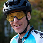
The finish — From CP6 there was a mere 10 miles to complete with the finish line being at the end of the pier in Scarborough. Those final ten miles took an hour to complete with my arrival time at The Diving Belle statue being 17:13 Saturday afternoon - some 19 hrs 25 minutes and 160 miles after starting in Morecombe.

Ride stats
Distance: 160 miles
Elapsed time: 19hr 25 mins
Ride time: 16hr 05 mins
Elevation gain: 4913 meters
Placing: mid-table!
Looking back on the ride there are certainly some improvements to be made in the route planning department but I’m pleased with the overall result as I was able to keep nausea at bay which has been my Achilles heel on other rides.
It was another stunning edition of Trans England put on by The Racing Collective. Next up Trans Wales. Join me if you fancy a jaunt down the length of Wales in May.