Trans England — what a ride! Starting from the west coast of England in Morecambe the route takes riders all of the way across England’s most remote places to finish on the east coast in Scarborough. It covers around 180 miles depending on how you route your own way across. The format of the event is designed to give riders a taste of what they can expect during multi-day self-supported ultra endurance events like the Trans Continental.
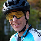
Organised by The Racing Collective the event is as grass roots as you can get and that makes it special. There are no timing chips issued to riders; instead, everyone’s passage through each of the five checkpoints is verified by posting a timestamped photo on Twitter with the hashtag #transengland21. How great is that! It also makes for some fantastic selfies as the race goes on, with some weary faces showing the effort involved.
Before setting off, riders are given GPS coordinates of the start, finish and five checkpoints. It’s up to each rider to choose their own route between checkpoints, which makes for some interesting choices. Do you stay on road and go the long way round to checkpoints or do you opt to take gravel shortcuts knowing that they will most likely be steeper and perhaps slower?
My ride started at 22:00 on Friday night, having driven to Scarborough that morning and then travelled by train (three of them) to the start in Morecambe. Given that we are still under COVID-19 restrictions, the start window was opened up to between 20:00 and 24:00 on Friday night, which ensured that there were never many riders in one place.


Having had a late pizza supper on Morecambe pier, it was time for me to start the ride. Adrenaline and nerves were on high alert knowing that as soon as I took the first timestamped photo that meant the race was on.
Photo taken, tweet posted, route to first checkpoint loaded on my Wahoo, it was now time to ride. What I seemed to have forgotten in all that was to actually start tracking my ride. 🤦🏽♂️ It was only after 5 miles when my Wahoo beeped at me to tell me it was powering off that I realised my mistake. A quick button press or two and I was finally tracking.
From the start, the first checkpoint was only 19 miles into the ride at St. Hubert’s Church. By this time darkness had fully enveloped us. As some other riders had also started around the same time, there was a steady stream of red rear lights to follow down the road. As there was really only one way to CP1, it was safe to assume that their route was going to be the same as my own. Later in the race, that was not the case.

I got to CP1 at 23:33 on Friday night and took a picture, posted a tweet, ate some food and said hi and goodbye to some of the other riders at the checkpoint. I then headed off in search of CP2 in the darkness.
I quite like the peace that comes with riding at night, with only your little bubble of light to worry about. By now, I had settled down to a pace that I knew I could manage over the upcoming hours of riding. My Wahoo would occasionally beep at me to indicate upcoming turns, but with the conditions being all but perfect the only other sound around at that time was my heavy breathing as I pulled on the handlebars and pushed on the pedal to help to get me up the inclines.
I wasn’t sure how I’d feel riding through the night but was pleasantly surprised that I wasn’t tired. I think the excitement of riding during the night chasing the rear lights of other riders helped me through.

The route so far had been on road, but the approach to CP2 would see the first of the off-road sections riding up to Cam Road. From the town of Settle, it’s a steady 13 mile incline up to 550 metres above sea level all the way to CP2, which I got to at 02:34 on Saturday morning. By now, I’d covered 53 miles with 128 miles to go.
The rhythm of the ride was established now: get to the checkpoint, take a photo, post a tweet, eat some food and then head off in search of the next checkpoint.
This time, the next checkpoint was only 16 miles away, so I naively though I’d get there in no time at all. What I seemed to have overlooked was elevation gain and terrain! Just under two hours later, I got to CP3 at the world famous Tan Hill Inn, which is Britain’s highest public house at 1,732 feet (528m) above sea level.
The ride between CP2 and CP3 was spectacular. That stretch alone was worth all the effort of getting to the start line and riding through the night. As we were riding eastbound, the sunrise was ahead, and by 03:30 it was light enough to begin to see the glory of the Yorkshire Dales.


I arrived at CP3 at 04:12, having completed 69 miles with 112 miles still to go. I’ll never forget that phase of the ride as I was joined en route by hares, nesting Curlews, Barn Owls and a very noisy dawn chorus.

My spirits were high as the sunrise was in front of me and, from the top of Tan Hill, it was generally downhill all the way to Richmond, some 25 miles away.
By now, I’d been riding for around six hours. There were still signs of other riders out on the route with the occasional wet tyre track on the tarmac, but we were all now riding our own race and managing the effort needed to get to the finish.
Coming off the Yorkshire Dales, riders took different routes to the next checkpoint. Some, like me, opted for a gravel approach to the next checkpoint whereas others took the road, which involved a few more miles.

Given the start time of the race and the terrain, resupply stops were few and far between. I had started the ride with enough food to get well into the race. My only problem was finding water. The bottles were getting empty, and with no shops likely to be open at that time in the morning, I started the game of spot the church in the hope that one of them would have a tap outside to refill.
Bingo! At Reeth, the church had a tap tucked away. With fresh water on board it was time to tackle the flat lands between the Yorkshire Dales and the North York Moors.


There were 61 miles between CP3 and CP4 and it was around this time that the ride was starting to take its toll. I also knew that the approach I’d opted for to CP4 involved the Ingleby Incline — a one-mile long disused railway track with a 20% gradient on gravel.
Having made the mistake on previous bike-packing rides of not having the right gearing for the job, I had made sure that, for this ride, I’d try and make my life easier by fitting a 36t chainring with 11–42 cassette. Having hit the bottom of the Ingleby Incline, it was very clear that even those gears were not going to cut it. The only way over this was by hike-a-bike. Even that proved a challenge!


The effort getting up over the top was soon rewarded with some great views across the moors to the south. I was now back up at 365 metres above sea level with CP4 in sight.

I arrived at St Nicholas Church (CP4) at 09:25, having ridden 130 miles. By now, I’d been awake for over 24 hours and had been cycling for 11 hours. As was now the tradition at checkpoints, I smiled, took a photo, posted a tweet, ate food and then headed off in search of the next checkpoint 51 miles away in Robin Hood’s Bay.

Given the effort that it took me to get over the Ingleby Incline, I was in a bit of a state at CP4. My chosen route was straight back onto gravel tracks, which involved more hike-a-bike. Knowing that my legs were shot, I decided to re-route and stay on the road for a little while longer, which still involved inclines that my legs just couldn’t get me over; more hike-a-biking was needed.
Overall, I was pleased with my equipment choices, having opted to ride the event on my Cotic Escapade gravel bike fitted with WTB Exposure 36c tyres. Many riders were undertaking the event on road bikes with 28c tyres. I’d say it was a 50:50 mix of gravel bikes and road bikes out on the course.
I rejoined my planned route nicely at the top Ledging Hill, which meant that I had the best decent ever into Castleton. Smooth rolling roads heading downhill. What more is needed in life on a bike?

Castleton was my first resupply stop after 144 miles and 12 hours of riding. By now, I had started to feel a little nauseous but managed to get a cheese and onion sandwich inside me, washed down with some Lucozade. Quality calories? I’m not so sure. Topped up with more water, I left the comfort of the Co-op kerbside with CP5 still 20 miles away. By now, I’d played every trick I could think of to try and chunk up the remaining miles in my head. Twenty miles, I thought; that’s just like a quick ride looping around at home. No problem.
The remaining miles continued to get mentally chunked up into smaller and smaller units. Somehow it helped as my legs were spinning, but with not much power in them, and my brain was certainly frazzled from the lack of sleep.

I got to checkpoint 5 at Robin Hood’s Bay at 13:13, having ridden 165 miles and climbed over 3,500 metres. With only 16 miles to go, it was time to get this done.
Going into Robin Hood’s Bay involves a 20% descent. Was I thrilled to find out that my gravel alternative route did not require me to go back up the 20% incline? Yes, I was! My route took a left turn from the bay onto a cycle path, which helped to reduce the miles from CP5 to the finish. However, the work was not quite over yet as this gravel shortcut followed a disused railway track that had a steady 3–4% ascent for 5 miles. On any other day, 3–4% gradients would pose no problem at all, but today, with all the miles and climbing in the legs, it was a long slow drag!
Relief was in sight; once over the top, it was 11 miles of slightly downhill all the way to the finish. With the coastline now on my left and a fresh breeze coming in off the sea, you could sense the finish line in Scarborough.

At 14:56 on Saturday, I completed the TransEngland at Scarborough in 16 hours 50 minutes, having covered 180 miles and climbed 4,200 metres. Boy, what a ride! We were treated to the best weather possible on a route that takes in some of England’s most wild places. A ride to remember.
I finished in 18th place out of 42 starters and only 33 finishers.
A huge thank you goes to the Racing Collective for having the inspiration to put on this ride. They run a series of road and gravel trials throughout the year, so take a moment to check out what’s on offer. Attending these types of events involves a lot of logistical challenges but the experience makes it all worthwhile.
Having used this ride as a test event for the Trans Pyrenees later this year, I have a few decisions to make. Mainly, could I do that ride again and again over five or six consecutive days? I have yet to answer that question.
Ride stats:
Distance: 180 miles
Elevation: 4200 metres
Elapsed time: 16:50
Ride time: 14:30
My setup:
Bike: Cotic Escapade
Tyres: WTB Exposure 36c
Bags: Restrap bags — frame, top tube, saddle, stem x2
Groupset: Shimano GRX 1x 36t 11/42
Wheels: 700c Boundary hand built dynamo wheels

More details of my full route are on my profile on Map My Tracks.
More photos on my Instagram profile @nicktatt